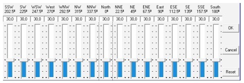
Most of us I’m sure do not have a flat horizon 360’. Mine can be 20 to the S and 70 on my west and 50 to my east with 30 to the north. I have cheap apps (observer pro is an awesome one) that lets me draw my horizon. APCC also lets me draw my horizon. Of course, those don’t do me any good in SGP. Lack of this makes the planner not very helpful. PLEASE allow us to define a custom horizon. Most do this using a degree 0-360 text file that has each elevation point… like 5,20 10,30 15, 32 20,34 all the way to 360. APCC does this and if compatible I could share the same data. If you don’t have it - get out the IOS app Observer Pro - it uses the device’s camera to pan the horizon to create it. It then will show when I can see a target exactly at my location and when it dips behind a tree. The planner really needs this to make it viable.
Fully agree. I also do this separately and almost avoid the planner because of this lack of custom horizon option.
Not to negate the request but I wonder if you are trying to image too close to the horizon? Anything below about 40-45 degrees is subject to a lot of atmospheric problems. If you stay above that limit, then the custom horizon is hardly necessary.
It is needed for me. I have trees high east and west. I image a target the minute it leaves the treetops and stop the minute it touches on the other side. With your suggestion, I’d have to set mine to 82! That would kill my ability to grab the Eagle Nebula at 30.
My treeline 360 degrees
0 39
5 39
10 44
15 44
20 44
25 54
30 59
35 59
40 59
45 59
50 54
55 49
60 44
65 44
70 49
75 49
80 44
85 44
90 34
95 34
100 39
105 39
110 34
115 29
120 24
130 19
140 19
150 29
160 29
170 29
180 24
190 24
200 19
205 24
210 29
215 30
220 33
225 31
230 31
235 29
240 27
245 37
250 41
255 44
265 44
270 45
275 44
280 74
285 81
290 81
295 81
300 82
321 81
338 81
348 81
358 74
Low elevation imaging is challenging. Look at the graph near the bottom of this link:
You can see that a star image size is about 2.5 times bigger at 30 degrees than at 45 degrees. Plus seeing issues increase at lower elevations.
While you folks are obviously correct…the lower the target, the more challenging the imaging, Ron’s request is absolutely a valid one (and one others have asked for as well).
Consider the situation where a single tree or building presents a barrier on one direction, but only briefly.
Consider the situation where a nearby line of trees presents varying horizons…all well above a “useful” altitude, but potentially costing you time depending on target location.
Or, possibly, consider the fact that many of us will image lower than you think “appropriate” because we simply enjoy imaging more than we worry about FWHM for the first 3 frames of the night. 
A custom horizon would be a tremendously useful modification to the planning tools, imo.
Lets keep things civil
Thanks,
Jared
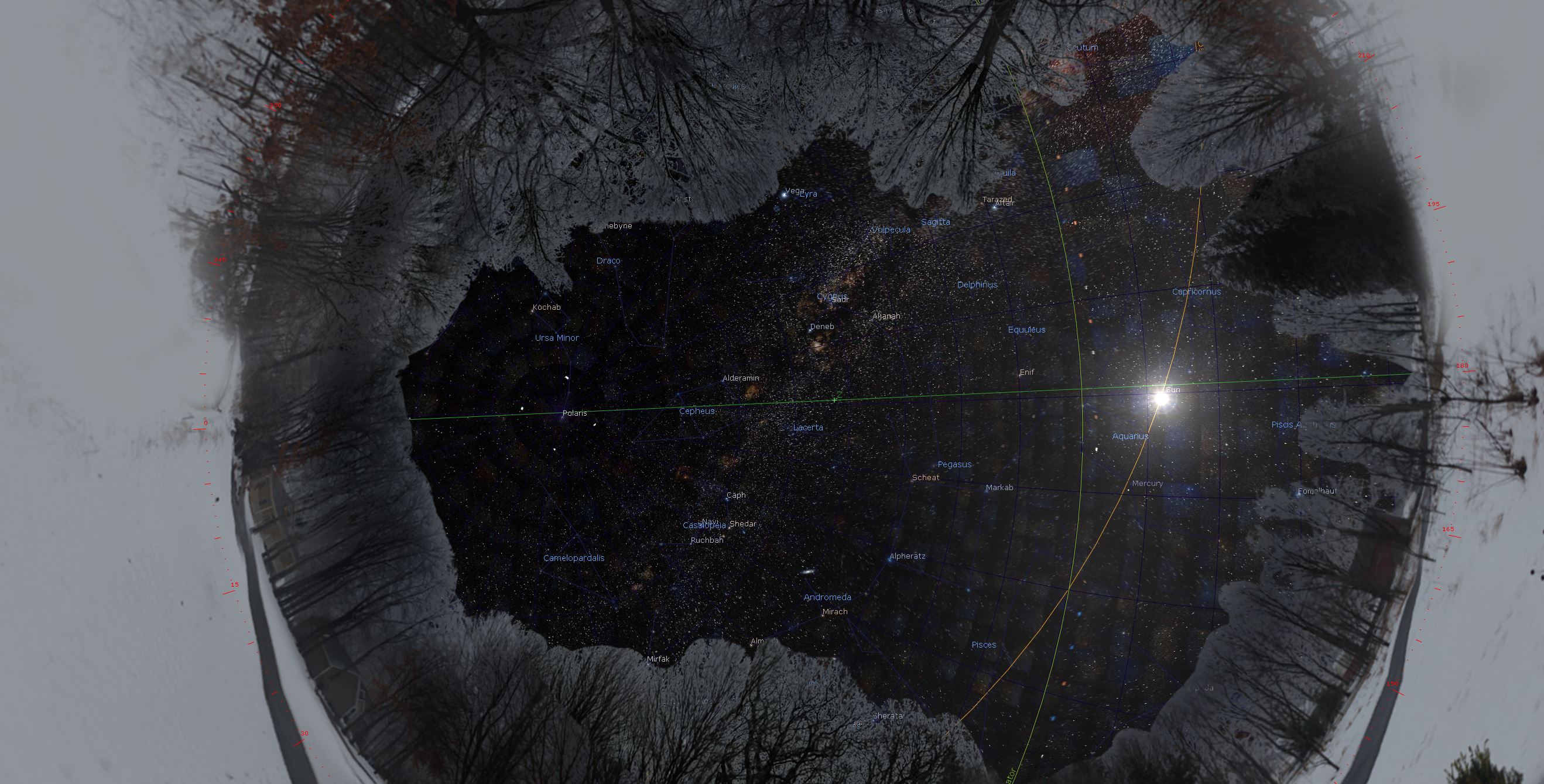
I found I could create a custom landscape for stellarium last night. Very welcomed.
It’s DSS is also a nice addition. Finally going back to it for my goto’s. Vs WWT.
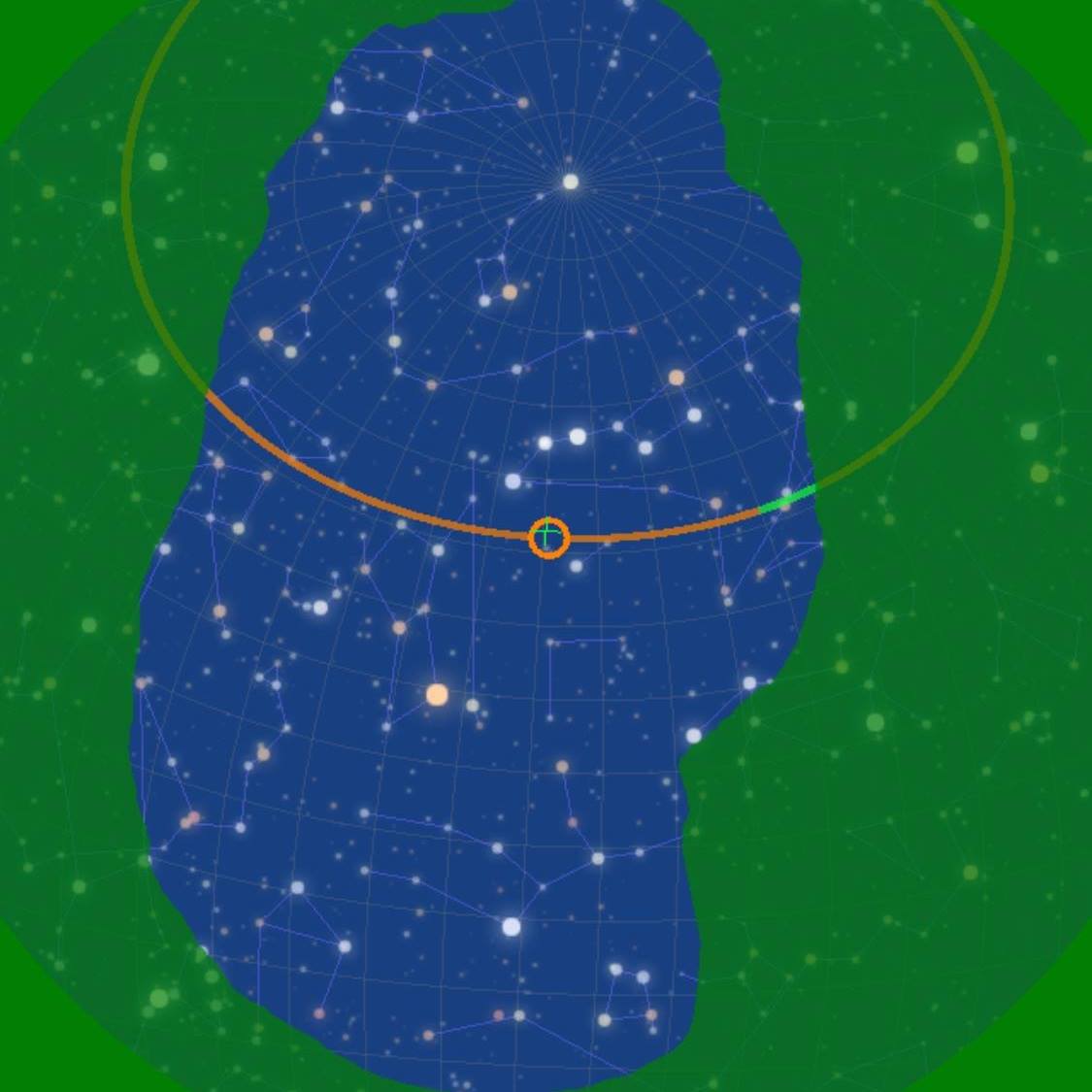
I took a 360 image of my garden and imported into Cartes du Ciel. You can calibrate it and it gives a fairly accurate visual indicator and aids my planning by seeing when the neighbouring houses interfere with the imaging.
Just another option.
It’s cool seeing my real horizon. Lets me know if a target is behind the tree’s before I slew there.
I don’t like cartes. (graphics are extremely crude). New stellarium has deep sky photos and a complete deep sky survey background now!
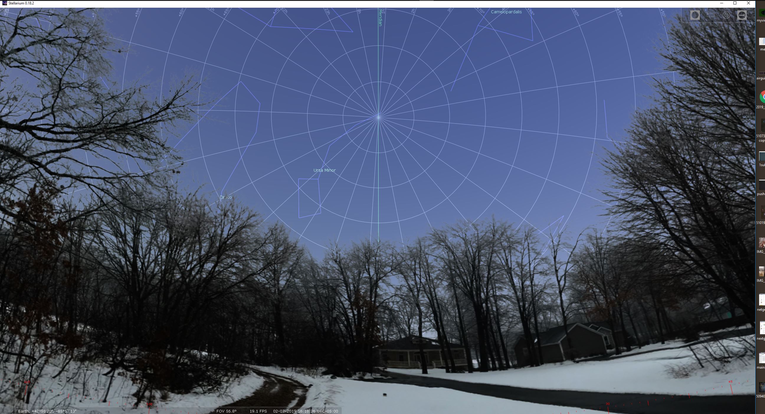
How complicated is it to create the custom horizon (360) in stellarium?
Tedious, but not hard.
Basically :
- Take pictures in a circle
- Stitch pictures together
- Delete sky (This is the most tedious part)
- Tweak a simple well-documented config file
Thanks for the info and link.
Agree, great request
see also my The SGP NewBie Questions - Sequence Generator - Main Sequence Software
first observation as newbie
Chris
Very good idea. In my case I have my house and a mountain at North (42)°, trees at West (35°) and I would like to stop the tracking before the object reach the trees. EQMOD can define an horizon profile but when the target reach this profile, the mount stop and SGP do not go to the next event. In fact the logic could be the same than the meridian flip: the EQMOD limit is farther than the SGP limit in order for SGP to react and manage the event.
Good idea.
Plus 1.
JM
Ken, Jared
I like to bring this discussion back to SGP, last night i discoverd the planning tool Great.
I understand it can be difficult to add function horizon and I don’t know the plans in relation to major release 4.0
My suggestion that we implement this request on agile way, I like to share my vision how we can do that in SGP, hoop that this give you some ideas also.
I think the only extra function is that SGP can plot the object on the angle of the horizondepending on the degree in hight which is already part of planning tool
Create Horizon like below, this can be part of User Profile Manager, depending on location different horizon
To do it on the agile way, bit by bit, I like to have two vertical lines for Object Rise and Set and Meridian flip so I can define the start and stop time base the horizon or flip
My suggestion is that this will looks like
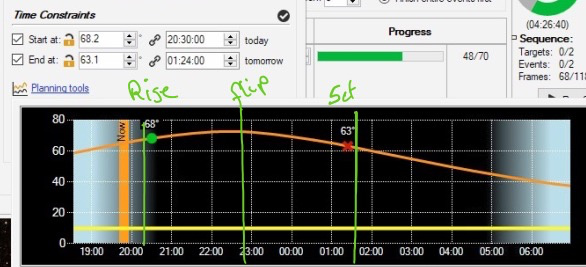
Is this possible to get this implemented. Start en stop times for now I can set via the mous clicks
Please tell me what you think about this idee.
And if this helps to provide you in this way with suggestion for a new feature.
Thanks in advance
Chris
Hi. Just wondering if you connect to your scope via SGP through Maxpoint (which is from where the horizon planner above comes) and through Maxpoint to your scope (in my case Pulsar2 for a G53F mount) if you could just use the horizon planner in Maxpoint to trigger your horizon limits? It does, of course, mean that you would need to obtain Maxpoint and the process wouldn’t be as convenient as if an horizon planned was integrated into SGP.
I agree, showing your object rise, set and meridian flip point would be helpful but I expect it would be difficult to include in the planner. If not, it would be a valuable addition.
Grobe
Thanks, for the support in this, wonder how Ken and Jared think about this if it is due able for a next release
Chris
Desertsky, don’t believe everything you read.
This target does not rise above 20 degree’s for me. I have to shoot it over several nights because it only appears for 90 minutes from behind a tree to my SE before it disappears behind a tree on my SW. Due to my varied horizon.
