i have been using 3.x for a while now and enjoying the altitude-based planning tool.
i guess when this was being initially discussed, i understood that the feature should let you set a start and end angle, and then night by night SGP would compute new start and end times. however, i think i’m not seeing this behavior happening. it seems to me that if i set up a target and then come back to it 2 weeks later, the start and end times are the same as when the target was created - evidenced by the target going into the trees at the end of the night.
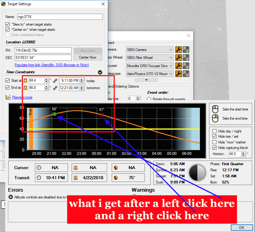
it seems like if i go into the planning tool and re-click the start and end markers, that the time is recomputed properly. but it doesn’t seem to happen automatically.
is this the right behavior or do i have something misconfigured?
Ferris Bueller? My best friend’s sister’s boyfriend’s brother’s girlfriend heard from this guy who knows this kid who’s going with a girl who saw Ferris pass-out at 31 Flavors last night. I guess it’s pretty serious.
As for this question you need to set the altitude and not the time. Either time or altitude is “locked”. If you set the altitude SGP will update the time night over night. If you update the time SGP will update the altitude night over night. Planning Tools will set the time if you use the mouse clicks.
is there any visual indication that time and not altitude was chosen? IOW is there an easy way to tell that it’s been configured one way and not the other? from reading the help file, i thought that if the little lock next to the time was locked, that the time would update night by night…
what i have been doing is setting the target up in astroplanner (where i have a custom horizon) and then clicking on SGP’s ‘curve’ in approximately the same places that astroplanner indicates that the target is visible. should i then exit the planning tools and re-enter the two altitudes that i ended up with by clicking on the graph?
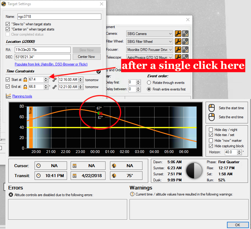
also, i just tried it again and now i know why i was doing it this way. the first time i did this, i used the planning tool since it seemed the easiest way to get the angles. not sure if it is a bug, but if the start time is before the meridian, the planning tool populates the angle as a positive number, possibly 90 - degrees_before_meridian. if i try to tweak that angle in the target settings, it snaps to a time that is past the meridian, and if i try to use the up/down arrows on the start altitude i can’t get back to a start time that makes sense.